Introduction
Sandakphu trek A pristine section of the eastern Himalayas can be found not far from the renowned Darjeeling Hills in the magnificent northern mountains of West Bengal, perilously close to and occasionally interspersing the borders with Nepal.
The Singalila Ridge, which runs north to south and is evenly distributed mostly in West Bengal, Sikkim, and partially in far-western Nepal, divides the Bengal Ranges from the other east-Himalayan Ranges West going forward. The Singalila National Park dominates, covering its undulating mountain range in unspoiled perpetual foliage and protecting some outstanding fauna within. Sandakphu is the highest point of this forested ridge.
Literally translated as “Peak of the Poison Plants,” Sandakphu means. The naming may have originated from a nearby bloom of a deadly plant genus. One example is the perennial shrub “Aconitus,” whose roots have been used as medicine for centuries, despite the fact that its vivid purplish-blue blooms and leaves can be fatally deadly if ingested carelessly. Another is the region’s abundant “Himalayan Cobra Lilies.”
In the world of trekkers, Sandakphu is well-known as a light-moderate hike. At a height of 11,930 feet, it is the top of the Singalila Ridge and the National Park. Which also makes it unique that it is the highest peak in the state of West Bengal.
What makes this unique?
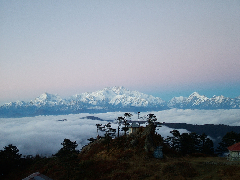
The fact that 4 out of the 5 tallest peaks in the world can be viewed from this remote hamlet on top of a ridge on a clear morning, especially in the early hours as dawn breaks, makes it a must-visit location in the eastern Himalayas.
In addition to the Sleeping Buddha’s five chambers, Mt. Everest, 29,029 feet, Lhotse, 27,940 feet, and Makalu, 27,838 feet, are all visible at sunrise, shining beautifully in the golden color.
Amazingly, the vista stretches from west to east and features peaks as far away as Arunachal, Nepal, Tibet, Sikkim, and Bhutan.
Is the only way to go to Sandakphu via foot?
No. It can be driven. But there’s a problem. Nobody can drive on the tarmac because it is not smooth. The difficult gravel-bluff track can only be completed by a reliable 44 SUV. It would also require excellent driving skills to get it to Sandakphu without any significant damage to the vehicle. The road was full of loose rocks, hazardous turns, and steep gradients.
Old Land Rovers from the colonial era used to travel between Manebhanjan and Sandakphu, even as far as Phalut, transporting tourists who were hesitant to hike to the top, but have recently (as of January 30, 2018) been banned by the local authorities under the pretext that the vehicles were not compliant with current safety norms.
This summer, JLR held a motorcade with all of its historical models to commemorate its 70th anniversary in the area. beginning with Series-I and ending with the most recent Discovery. The legacy of Land Rovers and how iconic this path has been for them speak for itself.
It used to be a boulder-gravel track for the full 30+ kilometers from Chitre (2 KM up from Manebhanjan) to Sandakphu and another 21 kilometers to Phalut (the second-highest mountain of the Singalila Ridge).
From Manebhanjan to a place named Gairibas, the path is currently 20 kilometers long and partially concrete and partially asphalt-paved. Both the final 12 and final 21 kilometers from Sandakphu to Phalut are unchanged.
The Ascent Path
In addition to the most popular trek route, which is from Manebhanjan, there are also additional trek routes (discussed later) that lead to Sandakphu. Manebhanjan to Sandakphu is a 32-kilometer ascent that is typically completed in three days.
Expert hikers can do it in a day or less. Trekking enthusiasts participate in an annual race that is similar to a marathon to run to the top. They reportedly do the entire distance in 7 to 10 hours.
Manebhanjan
At a height of 7050 feet, Manebhanjan is an unremarkable small wayside hill-town that is only perhaps noteworthy for serving as the entrance to the Singalila, or more specifically Sandakphu. The too-excited drivers will inquire after you if you exit the NJP railway station with cargo, hiking boots, and a backpack, “Manebhanjan?”
From here, the typical hike starts. An access permit for the Singalila National Park must be obtained here. Additionally, the obligatory guide and porters must be hired from the “Highlander Guides and Porters Welfare Association,” which is right next to the bazaar.
Tonglu
Tonglu, which is slightly higher than 10,000 feet, may be reached on foot in 6-7 hours. Since the road has been concreted, traveling the 11 KM from Mane shouldn’t even take an hour by car. Up to the charming tiny town of Chitre, the trail is fairly steep at first, almost as if to force someone embarking on his first significant walk to immediately second-guess his choice.
Tumling
Tumling (9600 feet) is located in Nepal’s Ilam district and is a few kilometers (miles) downhill from Tonglu. This charming small town is gradually becoming a destination unto itself, even for those who would not travel until Sandakphu, thanks to the fact that it offers better private stay alternatives than Tonglu.
Singalila National Park – A Snippet
The national park is home to uncommon plants and animals. The primary biome of the area is sub-alpine-subtropical eastern Himalayan pines and conifers. Along with more than 500 different varieties of orchids, several varieties of primulas, geraniums, and rhododendrons that give color during the two flowering seasons of the area, the entire trail travels past ageless Oak, Pine, Silver Fir, Birch, Magnolia, and several variants of Bamboo trees.
It won’t be unexpected to see destinations like Tonglu and Tumling become even more well-liked with mainstream leisure travelers now that the path has been paved.
Checkout: more awesome content


